This site uses cookies. By continuing to browse the site you are agreeing to our use of cookies. Read our privacy policy.
- Choose from…
-
Special Offers
- > Attractions
- > Activities
- > Shopping
- > Eat & Drink
- > Pubs & Clubs
- > Accommodation
- > Local Charities
- Attractions
-
Activities
- > Other
- > Adrenalin
- > Art/Creative
- > Bowling
- > Children's Indoor Play Areas
- > Cinemas & Theatres
- > Cycling/Walking
- > Escape Rooms
- > Fishing & Sea Safaris
- > Golf
- > Gym, Sports & Fitness Classes
- > Horse Riding
- > Spa Days
- > Surfing
- > Swimming Pools
- > Travel in Cornwall
- > Vineyard, Brewery & Distillery
- > Watersports
- Shopping
-
Eat & Drink
- > American
- > Asian
- > British
- > Cafe's
- > Chinese
- > Coffee Shop/Tea Room
- > Cornish Food
- > Fine Dining
- > Fish & Chips/Takeaway
- > Indian
- > Italian
- > Rest of the World
- > Seafood
- > Vegetarian
- Pubs & Clubs
- Accommodation
- What's On
- Information
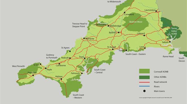
- Cornwall
- Local Charities
Camel Estuary
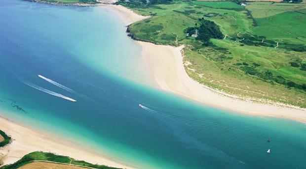
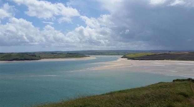
Images by John Such, Sean Hughes - supplied by Visit Cornwall
A tranquil and intimate landscape, it gains a sense of shelter and richness from the many small woods and creeks that flank the estuary. On the hilltops, the full impact of the coastal winds is felt, with long distance views down the estuary to the sea. Numerous small quays line the estuary and its creeks. Small lanes are bound by high hedges and overhung with trees, with the popular Camel Cycle Trail linking Bodmin and Padstow.
Description
The Camel Estuary is broad expanse of water at high tide, extensive mud flats and sandbanks at low tide. The Amble Marshes form a level area where water and land intermingle, giving rise to valuable salt marsh habitats attractive to wildlife such as wading birds. Cant Hill is a prominent rounded and steep sided landmark. Cornish hedges built of local slate and some the bare stone work of the locally characteristic herringbone pattern.
Contact Details
The Cornwall AONB Unit
Floor 4A, Pydar House
Pydar Street
Truro
Cornwall